
DGPS Goes the Way of the Dodo
- Jeff Pearson

- Jul 1, 2020
- 2 min read
You may need to be a navigation nerd to enjoy this, but if that's you, read on!
Yesterday, the U.S. Coast Guard switched off their last Differential Global Positioning System (DGPS) signals after more than 25 years of service. Improvements to the satellite-based Global Positioning System (GPS) have made DGPS redundant. Just in case you aren't a navigation nerd and decided to read this anyway, here's what DGPS did and why its no longer needed.
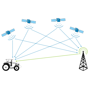
In it's early days, the Global Positioning System was not accurate enough to meet many applications, including the Coast Guard's positioning of aids to navigation. The Coast Guard developed its DGPS system to provide a corrected signal with an accuracy of 1 to 3 meters in most cases.
Here's how it worked. GPS receivers were set up at base stations along the coast. The base station compared the location data received from the GPS system to the station's known location and broadcast a correction signal to any GPS receivers in the area. The DGPS system broadcast out to 50 miles at sea and covered nearly the entire U.S. coast and the Great Lakes.
The replacement to the DGPS system is the Wide Area Augmentation System or WAAS. This system uses a network of ground-based reference stations to measure the GPS signal for accuracy. The reference stations transmit correction information to the satellite, which in turn transmits a corrected signal to GPS receivers.
While DGPS was a great success, but getting a corrected signal from the satellite means that mariners farther than 50 miles from the nearest DGPS transmitter have access to accurate positioning information. So, thanks U.S. Coast Guard and DGPS for a job well done!


Comments